Speaker:
These doublet earthquakes occurred in an area where Eurasian, Arabian and African Plates form a triple junction: the Maraş Triple Junction (MTJ). The 580 km long, NE-SW trending, left-lateral strike-slip East Anatolian Fault (EAF) forms the tectonic boundary between the Anatolian Block and the Arabian Plate. The 1.000 km long, N-S trending, left-lateral strike-slip Dead Sea Fault (DSF) forms the tectonic boundary between the African and Arabian Plates. These two major faults intersect at the Maraş Triple Junction.
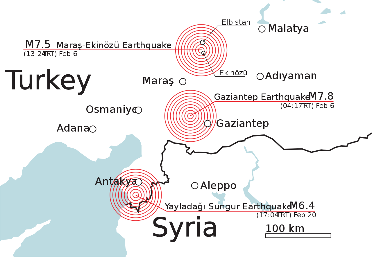
The first Mw=7.8 earthquake nucleated at the northernmost segment of the DSF. Its Centroid Moment Tensor (CMT) solution gives major left-lateral motion with a minor normal component. When the 42 km long rupture of DSF reached the junction with the EAF (Maraş Triple Junction), 10 seconds after the origin time, three fault segments of the EAF were ruptured bilaterally, with a duration of 70 seconds, creating a 343 km. long fault break. Thus, the previously identifed seismic gap along the EAF, which was inactive since 1513, was filled.
The second Mw=7.6 earthquake, which is triggered by the Mw=7.8 earthquake 9 hours later, nucleated roughly in the middle of an E-W trending Çardak Fault and it ruptured bilaterally creating a 100 km long fault break with a maximum 8.8 m. left-lateral displacement. However, the Çardak fault rupture did not continue along the Sürgü Fault segment to the east, instead it propagated in NE direction rupturing a previously unmapped fault for 44 km. The known last major earthquake was occurred in 1544 on the Çardak Fault.
The dense Turkish Strong Motion Instrument Network (AFAD-TADAS) recorded the accelarations created by these earthquakes. Especially in Antakya and Islahiye the recorded horizontal accelarations exceeded 1,000 cm/s2. These accelarations exceeded the design envelopes of the Turkish Seismic Design Code of 2019 even for critical structures (average 2475 year return period) for periods larger than 0.5 seconds due to alluvial basin magnification and rupture directivity effects and they can partly explain the wide spread damage to buildings and infrastructure."